Terrain Minerals has identified a coherent 4km-by-3km multi-element gold-pathfinder anomaly at its Carlindie project near Port Hedland in WA, where first-pass soil geochemical results have lined up with a concealed greenstone target generated by machine learning. The company is planning field reconnaissance in July before rolling out an ultra-fine soil sampling program from August to home in on the target area and guide future drilling.


Terrain Minerals has identified a coherent 4km-by-3km multi-element gold-pathfinder anomaly in the northeast of its Carlindie project near Port Hedland in WA. The results coincide with a concealed greenstone target generated independently by machine learning.
The anomaly was defined in first-pass elevated soil geochemical results from a program involving 813 samples on a 200m by 200m grid, along a 15km trend running west-northwest from the anomaly, which lies at the eastern end of the sampling grid.
The company says the coincidence of the hidden greenstone and geochemical results gives it a strong base to step up exploration at Carlindie, with field reconnaissance pencilled in to begin in July, ahead of a follow-up UltraFine+ soil geochemical sampling program from August.
The geochemical anomaly, reflected in higher-than-background results for arsenic, antimony, bismuth, tungsten and caesium, was successfully identified in conventional sieved soil sampling despite the presence of transported cover.
Areas of deep transported cover, such as windblown sand or sheetwash and even areas of intense weathering, can mean that conventional surface geochemical sampling methods may be less effective.
For this reason, geochemical sampling in such areas may resort to more sophisticated measures. These can include analyses with lower-than-usual detection limits for the elements sought or may modify the size fractions being evaluated. Alternatively, both methods may be applied.
The anomaly at Carlindie carries extra weight because it sits partly over a concealed greenstone belt, a geological setting often associated with major mineral discoveries. Significantly, the target was independently highlighted by Perth-based consultancy RSC through machine-learning analysis of regional geophysical datasets, providing a second line of evidence pointing to the same area.
Terrain Minerals executive director Justin Virgin said: “We believe this project represents one of the most exciting opportunities in Terrain’s portfolio. The Company has secured a large, contiguous land position in the East Pilbara, covering a highly underexplored area that sits beneath shallow soil cover and has seen little to no historical drilling.”
Terrain says the footprint of the gold-pathfinder anomaly also occupies an area ranked by the study as being prospective for both gold and lithium.
Within the broader anomaly, one sample returned coincident bismuth of 9.91 parts per million and tungsten of 6.74 parts per million, more than 10 times background levels and on trend with the wider arsenic-antimony cluster. That particular site is now the company’s top follow-up target for the July field trip.
Terrain’s Carlindie tenure is 90km southeast of Port Hedland. It sits between ground held by Wildcat Resources and SQM-Kali Metals, in a part of the lithium exploration hotspot that has become an increasingly fertile hunting ground for both gold and lithium discoveries.
Terrain has previously pointed to the nearby Tabba Tabba lithium system and Northern Star’s nearby Hemi gold discovery as examples of what can emerge from systematic exploration under shallow cover.
The company’s next field phase will combine on-ground reconnaissance prospecting and rock-chip sampling. It will also employ a staged follow-up geochemical soil sampling program using ultrafine screening of soil material.
The method is often employed because the finer clay fractions, which typically comprise a more significant part of the sieved fine fraction, often retain geochemical signatures within their crystal lattices.
Notably, they also comprise a vastly greater surface area for geochemical signature to attach to, making them far more effective at detecting subtle mineralisation signals than coarser sediment samples.
The sampling program will be rolled out in stages and tailored to the local ground conditions, allowing each phase to be adapted to the specific regolith and cover encountered across the target area.
The process often begins with orientation sampling to assess the best sample mesh size and volume needed to generate credible and repeatable results in the local terrain.
Terrain is effectively undertaking that step through a first-pass 200m by 200m grid spacing across the footprint of the south-eastern gold-pathfinder anomaly to validate the multi-element response before proceeding with more extensive sampling.
The object of the proposed soil sampling program is to validate and tighten the footprint of the original conventional soil anomaly while expanding geochemical coverage beyond its current boundaries. By extending sampling to the north and south, Terrain aims to sharpen drill targets and build a clearer picture of the project's broader mineral potential.
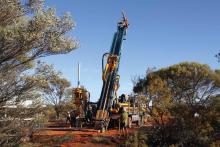
With up to 100 drillholes already approved at Carlindie, subject to heritage clearances, Terrain might have found a clear run at testing one of its more interesting East Pilbara targets and validating not only the original anomaly but also the sampling technique itself, which may be valuable in future exploration.
Is your ASX-listed company doing something interesting? Contact: matt.birney@businessnews.com.au